Agriculture & Food Security
Geospatial Applications for Food Security and Sustainable Landscapes in Burma (Myanmar)
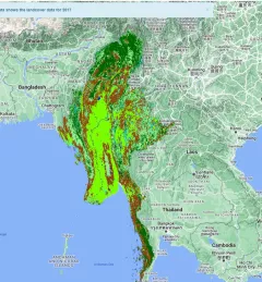
The Geospatial Applications for Food Security and Sustainable Landscapes service aims to improve food security in Burma (Myanmar) by improving crop planning and forest landscape management practices in the country.