Fact Sheet
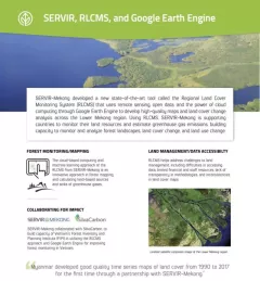
Factsheet: Mekong Regional Land Cover Monitoring System (RLCMS)
SERVIR, RLCMS, and Google Earth Engine

8 results
Enhancing Anticipatory Actions for Disaster and Climate Resilience aims to reduce the loss of lives and damage to properties and crops from floods and droughts by improving early warnings using satellite data and geospatial information.
Through the Supporting Flood Emergency Preparedness for Myanmar Service, SERVIR Mekong co-developed and supported the use of a systematic decision-support tool for the Myanmar Department of Disaster Management to identify areas with high flood risk.
The objective of the Supporting Near Real-Time Flood Monitoring in Myanmar Service was to develop a multi-sensor based near real-time flood monitoring tool to support the Myanmar Department of Disaster Management (DDM) in monitoring flood events.
Recently, the SERVIR-Mekong team added three new tools to aid in the environmental monitoring of the Mekong River Basin.

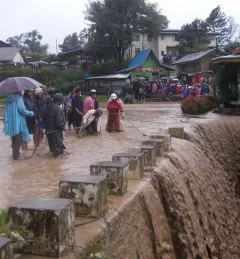
Changes in river morphology including floods, erosion, and landslides are affecting ecosystem habitats and the lives and livelihoods of communities living along Myanmar's rivers. SERVIR-Mekong is using satellite-based monitoring tools to support Myanmar agencies and communities to manage the risks better.
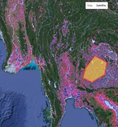
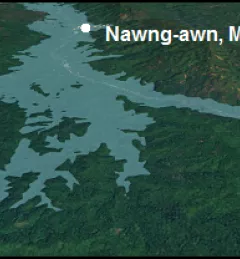
The Ayeyarwady River in Myanmar is one of the largest free-flowing rivers in the region and serves as the fulcrum around which Myanmar society and economy revolves.

The Hindu Kush Himalayan (HKH) region is no stranger to water- and weather-induced hazards. Every year, these disasters result in loss of lives, livelihoods, and damage to infrastructure throughout HKH countries.