Video
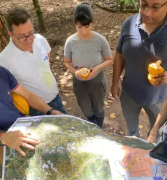
Regional Drought Monitoring and Early Warning System

SERVIR scientists discuss the how the Regional Drought Monitoring and Early Warning System is being used in the Hindu Kush Himalaya region.

56 results
SERVIR scientists discuss the how the Regional Drought Monitoring and Early Warning System is being used in the Hindu Kush Himalaya region.
This fact sheet provides an overview of SERVIR-Amazonia, which is part of SERVIR Global, a joint development initiative of the U.S. National Aeronautics and Space Administration (NASA) and the United States Agency for International Development (USAID).
This brochure provides an overview about SERVIR Amazonia.
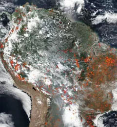
The Amazon Rainforest, often referred to as the "lungs of the Earth," plays a vital role in global climate regulation and biodiversity preservation.
|Prakrut Kansara, PhD and Benjamin Zaitchik, PhD, SERVIR Applied Sciences Team
The Monitoring Forest Dynamics to Enable Biodiversity Conservation in the Amazon service - now completed - helped introduce "TerraBio," a monitoring tool to assess the impact of private sector engagement on biodiversity conservation in the Amazon.
It may seem like farming is the enemy when it comes to preventing deforestation in the Amazon—and with good reason. The expansion of large-scale farming and cattle ranching is a leading cause of deforestation. However, the role of small-scale farming is less understood.
|Lena Pransky, NASA Science Coordination Office
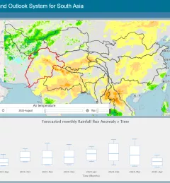
The Regional Drought Monitoring and Outlook System (RDMOS) was developed to help predict, mitigate, and adequately respond to drought vulnerabilities in the HKH region.
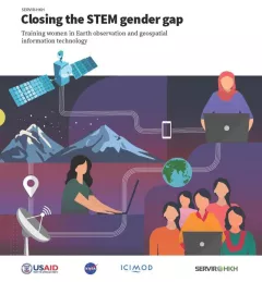
Between 2018 and 2021, SERVIR HKH trained 410 women in “Empowering women in GIT” to bridge the technology and gender gap in the region. Some of the key outcomes of these trainings are summarized in this report.
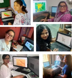
Since 2018, SERVIR has conducted 12 training programs for young and early-career women in geospatial information technology (GIT), reaching 1,490 women across the region. The training focuses on using technologies to collect, store, analyze, and visualize spatial or geographic data about observing the Earth’s surface and human activity. Participants learn about key concepts and how to use applications that depend on EO data and GIT.
|Jaber Hassan and Poonam Tripathi, SERVIR HKH
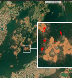
The Monitoring of Gold Mining in the Peruvian Amazon service produces near real-time information on deforestation and mining activity in the southern Peruvian Amazon.