Ecosystem & Carbon Management
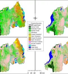
Ecological Modeling Service
The Ecological Modeling Service uses select data sources, derived products, and modeling techniques to better understand the distribution and spread of invasive species.