
Articles & Stories
Serving Governments' Climate Data Needs

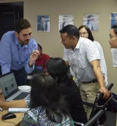
SERVIR's service planning approach brings partners, stakeholders, and end users into the design process from the very beginning, even before solutions are discussed.


![SHUKLA_Shrad_photo[1].jpeg](/sites/default/files/styles/card_flag/public/article/image/SERVIR-HKH_thematic_illustration.jpg.webp?itok=isSkllDk)