Video
Regional Drought Monitoring and Early Warning System

SERVIR scientists discuss the how the Regional Drought Monitoring and Early Warning System is being used in the Hindu Kush Himalaya region.

155 results
SERVIR scientists discuss the how the Regional Drought Monitoring and Early Warning System is being used in the Hindu Kush Himalaya region.
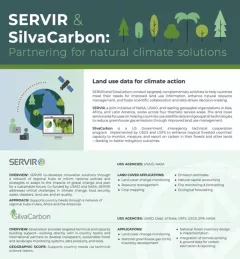
SilvaCarbon is an important collaborator with SERVIR.
The U.S. Forest Service is hosting webinars to introduce an online training course on Remote Sensing for Forest Cover Change Detection. This activity comes as part of the USAID-funded SilvaCarbon initiative.
The GeoFem: Women in Geospatial Technologies workshop was hosted and organized by the Inter-American Institute for Cooperation on Agriculture (IICA) and the Central America Aerospace Network (RAC) in San José.
|Lena Pransky, NASA Science Coordination Office
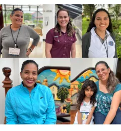
Meet four participants from the GeoFem Women in Geospatial Technologies workshop was hosted and organized by the Inter-American Institute for Cooperation on Agriculture (IICA) and the Central America Aerospace Network (RAC) in San José in November 2023.
|Lena Pransky, NASA Science Coordination Office

From a modest upbringing in a plaster-coated, mud-and-bamboo house in Kampala, Uganda to sharing the million dollar Al Sumait Prize for African Development, Assistant Professor Catherine Nakalembe’s life could easily become a Hollywood movie.
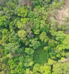
It may seem like farming is the enemy when it comes to preventing deforestation in the Amazon—and with good reason. The expansion of large-scale farming and cattle ranching is a leading cause of deforestation. However, the role of small-scale farming is less understood.
|Lena Pransky, NASA Science Coordination Office
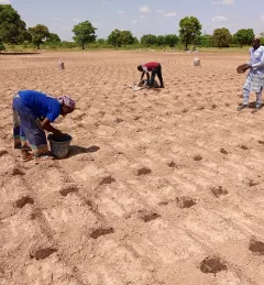
When irrigation isn't available, it's important to know when to expect rain. But with changes to our climate, farmers in West Africa can no longer count on a predictable weather. To mitigate this, SERVIR West Africa works with AGRHYMET to improve access to reliable weather and crop forecasts.
|Jacob Ramthun, SERVIR Science Coordination Office
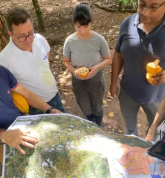
Rainforests are some of Earth’s most vulnerable ecosystems, but also some of the most difficult to monitor. With support from SERVIR, experts in Costa Rica are increasingly using radar to see through the clouds that make rainforests so hard to study. What they learn may help guide other countries in the future.
|Jacob Ramthun and Lena Pransky, NASA Science Coordination Office
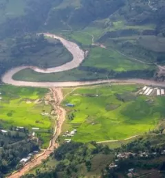
Nepal’s National Land Cover Monitoring System represents a pivotal achievement and is poised to significantly enhance the country’s climate data and efforts to cut emissions and adapt to climate change. This system is important for assessing and overseeing the ever-changing landscape, which is crucial for the sustainable stewardship of Nepal’s natural resources.
|Jaber Hassan and Sajana Maharjan, SERVIR HKH