Articles & Stories
Making Forecasts a Breeze

NASA supports local experts around the world to help their communities access and use weather and climate information.

26 results
NASA supports local experts around the world to help their communities access and use weather and climate information.
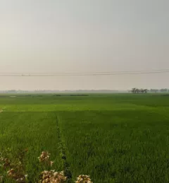
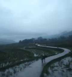
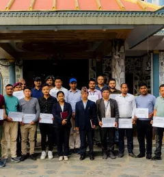
SERVIR-HKH has been helping the FFWC/BWDB build forecasting capabilities through the enhanced use of Earth observation and geospatial information technology.
|Manish Shrestha, Hydrologist at SERVIR HKH/ICIMOD
With support from organizations such as the Asian Disaster Preparedness Center, SERVIR scientists like Dr. Narendra Das of Michigan State University are working with our regional hubs and other stakeholders on models that will better predict crop yields in the face of climate change.
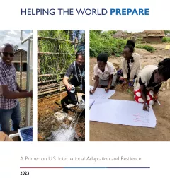
Through SERVIR, USAID and NASA play a key role in supporting the President’s Emergency Plan for Adaptation and Resilience (PREPARE). Our work was recently highlighted in the new White House publication “Helping the World PREPARE: A Primer on U.S. International Adaptation and Resilience.”

USAID’s 2024-2028 Geospatial Strategy promotes leveraging the power of geospatial data and technology to target the delivery of international programs.
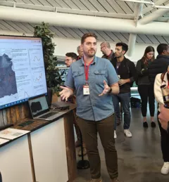
At Google’s Geo for Good (G4G) Summit 2023 in Mountain View, California, SERVIR scientists explained how and its collaborators are using artificial intelligence (AI) get more out of Earth data.
| Jake Ramthun, Biplov Bhandari, and Tim Mayer, NASA Science Coordination Office

SERVIR will be at the American Geophysical Union (AGU) fall conference December 11 - 15, 2023. We have compiled a list of SERVIR affiliated colleagues who will be presenting throughout the week. Please come and meet us at our talks and posters.

The end of one year and the start of the next provides an opportunity to reflect on past achievements and future goals. In 2023, the SERVIR network worked with local partners in the design and implementation of numerous geospatial services to address complex challenges related to climate change.

ClimateSERV is a web-accessible system that allows users to access, visualize, and analyze historical Earth observations useful to decision-making across multiple sectors.
As part of this service, SERVIR HKH, with the technical support of Brigham Young University developed a streamflow prediction tool that incorporates all primary and secondary rivers in the HKH region