Strategy & Guidance
USAID Geospatial Strategy

USAID’s 2024-2028 Geospatial Strategy promotes leveraging the power of geospatial data and technology to target the delivery of international programs.

7 results
USAID’s 2024-2028 Geospatial Strategy promotes leveraging the power of geospatial data and technology to target the delivery of international programs.

SERVIR will be at the American Geophysical Union (AGU) fall conference December 11 - 15, 2023. We have compiled a list of SERVIR affiliated colleagues who will be presenting throughout the week. Please come and meet us at our talks and posters.

The end of one year and the start of the next provides an opportunity to reflect on past achievements and future goals. In 2023, the SERVIR network worked with local partners in the design and implementation of numerous geospatial services to address complex challenges related to climate change.
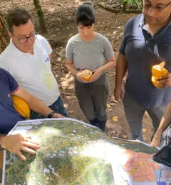
It may seem like farming is the enemy when it comes to preventing deforestation in the Amazon—and with good reason. The expansion of large-scale farming and cattle ranching is a leading cause of deforestation. However, the role of small-scale farming is less understood.
|Lena Pransky, NASA Science Coordination Office
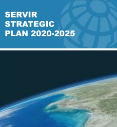
This strategic plan identifies the next set of cross-cutting strategic priorities that will ensure SERVIR remains responsive to both NASA and USAID Agency goals and those of stakeholders and users in SERVIR regions.

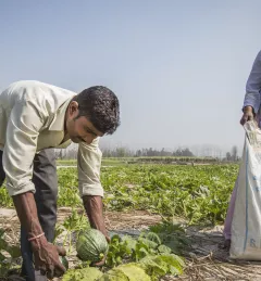
SERVIR improves local and regional capacity to provide tools, products, and services that empower decision makers to better address critical issues related to food security, water resources, natural disasters, land use, and extreme weather. Building on thirteen years of experience, SERVIR has grown in its geographical reach and has adapted its approach based on lessons learned.
After Afghanistan, Nepal, and Pakistan, the Regional Drought Monitoring and Outlook System extends its coverage to Bangladesh.