Articles & Stories
Making Forecasts a Breeze

NASA supports local experts around the world to help their communities access and use weather and climate information.

22 results
NASA supports local experts around the world to help their communities access and use weather and climate information.
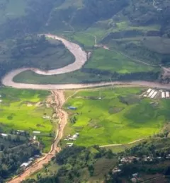
SERVIR-HKH has been helping the FFWC/BWDB build forecasting capabilities through the enhanced use of Earth observation and geospatial information technology.
|Manish Shrestha, Hydrologist at SERVIR HKH/ICIMOD
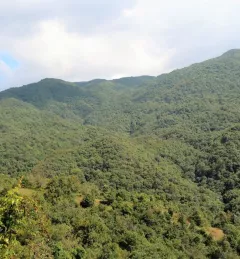
The Resilient Forest Management in Nepal is designed to assess the current state of forest ecosystems, identify the drivers of change, and explore suitable adaptation and mitigation measures.
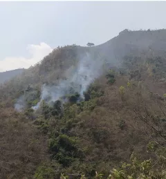
Between January 1st and June 16, 2023, Nepal experienced 118% more forest fires than it had in all of 2022.
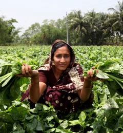
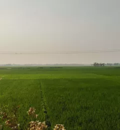
Bangladesh is a densely populated country where most people live in rural areas, and land management is critical to their well-being.
|Kabir Uddin, SERVIR Hindu Kush Himalaya

USAID’s 2024-2028 Geospatial Strategy promotes leveraging the power of geospatial data and technology to target the delivery of international programs.

SERVIR will be at the American Geophysical Union (AGU) fall conference December 11 - 15, 2023. We have compiled a list of SERVIR affiliated colleagues who will be presenting throughout the week. Please come and meet us at our talks and posters.

The end of one year and the start of the next provides an opportunity to reflect on past achievements and future goals. In 2023, the SERVIR network worked with local partners in the design and implementation of numerous geospatial services to address complex challenges related to climate change.
Nepal’s National Land Cover Monitoring System represents a pivotal achievement and is poised to significantly enhance the country’s climate data and efforts to cut emissions and adapt to climate change. This system is important for assessing and overseeing the ever-changing landscape, which is crucial for the sustainable stewardship of Nepal’s natural resources.
|Jaber Hassan and Sajana Maharjan, SERVIR HKH

ClimateSERV is a web-accessible system that allows users to access, visualize, and analyze historical Earth observations useful to decision-making across multiple sectors.