Articles & Stories
Making Forecasts a Breeze

NASA supports local experts around the world to help their communities access and use weather and climate information.

15 results
NASA supports local experts around the world to help their communities access and use weather and climate information.
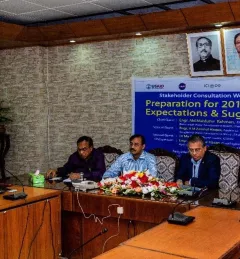
SERVIR-HKH has been helping the FFWC/BWDB build forecasting capabilities through the enhanced use of Earth observation and geospatial information technology.
|Manish Shrestha, Hydrologist at SERVIR HKH/ICIMOD

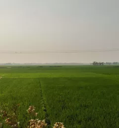
The cryosphere — snow, ice, and permafrost — is an important source of water in the Hindu Kush Himalaya.
|Faisal M. Qamer and Sher Muhammad, SERVIR HKH/ICIMOD

USAID’s 2024-2028 Geospatial Strategy promotes leveraging the power of geospatial data and technology to target the delivery of international programs.

SERVIR will be at the American Geophysical Union (AGU) fall conference December 11 - 15, 2023. We have compiled a list of SERVIR affiliated colleagues who will be presenting throughout the week. Please come and meet us at our talks and posters.

The end of one year and the start of the next provides an opportunity to reflect on past achievements and future goals. In 2023, the SERVIR network worked with local partners in the design and implementation of numerous geospatial services to address complex challenges related to climate change.

ClimateSERV is a web-accessible system that allows users to access, visualize, and analyze historical Earth observations useful to decision-making across multiple sectors.
Enhancing Flood Early Warning Services aims to build the resilience of vulnerable communities in the Hindu Kush Himalayan region by increasing flood forecast lead times that are hosted on an interactive web platform.
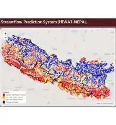
The Nepal DHM is the national agency responsible for monitoring and managing the hydrological resources of Nepal. This Use Case describes how they used the SERVIR Enhancing Flood Early Warning Services (EWS).
As part of this service, SERVIR HKH, with the technical support of Brigham Young University developed a streamflow prediction tool that incorporates all primary and secondary rivers in the HKH region