Strategy & Guidance
USAID Geospatial Strategy

USAID’s 2024-2028 Geospatial Strategy promotes leveraging the power of geospatial data and technology to target the delivery of international programs.

11 results
USAID’s 2024-2028 Geospatial Strategy promotes leveraging the power of geospatial data and technology to target the delivery of international programs.

SERVIR will be at the American Geophysical Union (AGU) fall conference December 11 - 15, 2023. We have compiled a list of SERVIR affiliated colleagues who will be presenting throughout the week. Please come and meet us at our talks and posters.
Disaster preparedness and the water resource management require reliable and timely information. In many regions of the world, ground observation data is scarce. Here are three ways that SERVIR's innovative services and tools enable decision-makers and authorities to address water challenges.
|Chinmay Deval, NASA SCO Water Security Lead
The Development and Management of Groundwater Analysis and Information System in Niger is a platform to improve and make available information on groundwater in Mar
The Regional Stream Flow Monitoring and Forecasting Service was designed to provide real-time streamflow forecasts for several watersheds in East Africa and bias-corrected satellite precipitation products to enable the timely prediction and monitoring of extreme events.
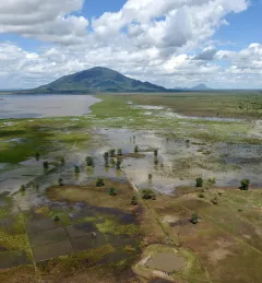
The Satellite-Based Water Quality Monitoring Service leverages Earth observing satellite information to assess historical water quality changes of in-land trans-boundary lakes.
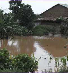
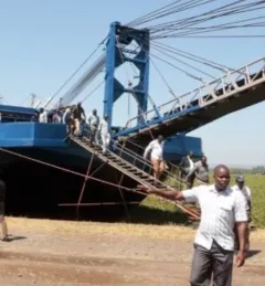
Like many rivers across the world, the Nzoia River in western Kenya pushes over its banks each year. In recent years, to protect lives and property in Kenya, SERVIR-Eastern & Southern Africa (E&SA) at the Regional Center for Mapping of Resources for Development (RCMRD) has provided high-accuracy flood level scenario maps to the World Bank to guide their flood protection dike repairs in the region.
The Uganda Directorate of Water Resources Management manages and develops Uganda’s water resources in an integrated and sustainable manner.
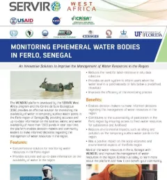
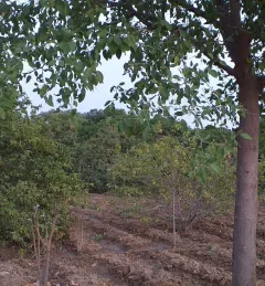
This fact sheet describes how SERVIR West Africa works with local stakeholders to strengthen the resilience of pastoral systems in Senegal.

SERVIR improves local and regional capacity to provide tools, products, and services that empower decision makers to better address critical issues related to food security, water resources, natural disasters, land use, and extreme weather. Building on thirteen years of experience, SERVIR has grown in its geographical reach and has adapted its approach based on lessons learned.