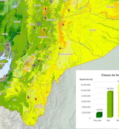
Mapping Soil Fertility in Ecuador

The Mapping Soil Fertility in Ecuador service, in collaboration with the Ecuadorian Ministry of Agriculture, generated high-resolution (30 m) digital soil maps of key nutrients for agricultural development.
Welcome to the SERVIR Global Service Catalog, a searchable collection of our demand-driven geospatial services that use Earth observations and climate data to support decision making and climate resilient development in the following areas:
67 results