Infographic
Commitment to Gender Inclusion
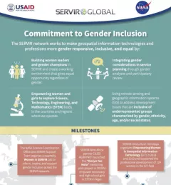
Learn more about how the SERVIR network works to make geospatial information technologies and professions more gender responsive and inclusive.

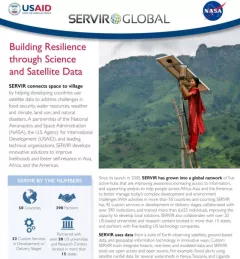
497 results
Learn more about how the SERVIR network works to make geospatial information technologies and professions more gender responsive and inclusive.

SERVIR scientists discuss the how the Regional Drought Monitoring and Early Warning System is being used in the Hindu Kush Himalaya region.
Enhancing Anticipatory Actions for Disaster and Climate Resilience aims to reduce the loss of lives and damage to properties and crops from floods and droughts by improving early warnings using satellite data and geospatial information.
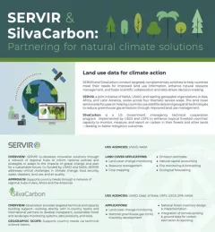
SilvaCarbon is an important collaborator with SERVIR.
This fact sheet outlines how the SERVIR Southeast Asia (SEA) Regional Hub uses publicly available satellite technologies to support regional institutions, governments, and communities adapt to transboundary climate issues and mitigate the impacts of climate change.
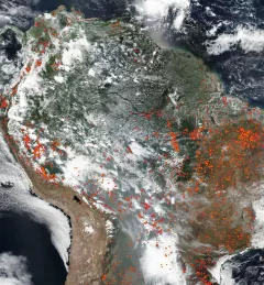
This fact sheet provides an overview of SERVIR-Amazonia, which is part of SERVIR Global, a joint development initiative of the U.S. National Aeronautics and Space Administration (NASA) and the United States Agency for International Development (USAID).
This fact sheet provides and overview SERVIR West Africa phase 2 implementation, which includes a consortium of seven regional institutions in Burkina Faso, Ghana, Niger, Nigeria, Mali and Senegal.
This brochure provides an overview about SERVIR Amazonia.
The Amazon Rainforest, often referred to as the "lungs of the Earth," plays a vital role in global climate regulation and biodiversity preservation.
|Prakrut Kansara, PhD and Benjamin Zaitchik, PhD, SERVIR Applied Sciences Team