Infographic
SERVIR's Service Approach

SERIR uses a "service" approach to identifying and addressing climate challenges.

18 results
SERIR uses a "service" approach to identifying and addressing climate challenges.
The U.S. Forest Service is hosting webinars to introduce an online training course on Remote Sensing for Forest Cover Change Detection. This activity comes as part of the USAID-funded SilvaCarbon initiative.
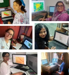
Since 2018, SERVIR has conducted 12 training programs for young and early-career women in geospatial information technology (GIT), reaching 1,490 women across the region. The training focuses on using technologies to collect, store, analyze, and visualize spatial or geographic data about observing the Earth’s surface and human activity. Participants learn about key concepts and how to use applications that depend on EO data and GIT.
|Jaber Hassan and Poonam Tripathi, SERVIR HKH

ClimateSERV is a web-accessible system that allows users to access, visualize, and analyze historical Earth observations useful to decision-making across multiple sectors.
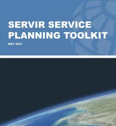
The Service Planning Toolkit is a resource for SERVIR Hubs and their partners to implement SERVIR's service planning approach.
Working in developing countries around the world, SERVIR seeks to incorporate regional knowledge and perspectives to best meet end user needs in addressing issues such as flood forecasting, forest fire management, landslide hazard, agricultural monitoring, and biomass estimation.
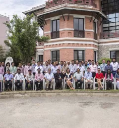
Team members of the NASA/USAID SERVIR program converged in Huntsville, Alabama, for a special workshop 18-22 April 2016.
Through SERVIR, NASA's Earth Science Division's Applied Sciences Program advances the use of space-based observations to inform policy and decision makers as they adapt to the impacts of global change and plan for a sustainable future.
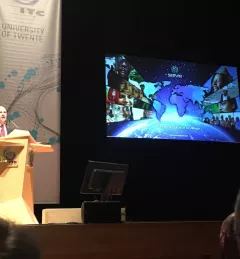
On September 22, 2016, SERVIR NASA Global Program Manager Dan Irwin delivered the prestigious Schermerhorn Lecture at the Opening of the Academic Year 2016-2017 of the University of Twente, Faculty of Geo-Information Science and Earth Observation.