Articles & Stories
Using open-source remote sensing data and tools to monitor forest carbon in Bangladesh
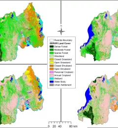
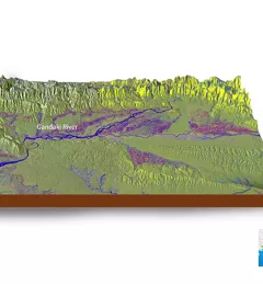
SAR can effectively measure and monitor forest biomass and forest carbon at national scales, particularly in tropical regions.