Infographic
SERVIR's Service Approach

SERIR uses a "service" approach to identifying and addressing climate challenges.

8 results
SERIR uses a "service" approach to identifying and addressing climate challenges.
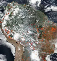
The Amazon Rainforest, often referred to as the "lungs of the Earth," plays a vital role in global climate regulation and biodiversity preservation.
|Prakrut Kansara, PhD and Benjamin Zaitchik, PhD, SERVIR Applied Sciences Team

SERVIR improves local and regional capacity to provide tools, products, and services that empower decision makers to better address critical issues related to food security, water resources, natural disasters, land use, and extreme weather. Building on thirteen years of experience, SERVIR has grown in its geographical reach and has adapted its approach based on lessons learned.

The newly-launched SERVIR Service Catalogue is improving access to geospatial services to inform decision making and improve resilience in critical areas like food security, water management, disaster resilience, and sustainable land and ecosystem management.
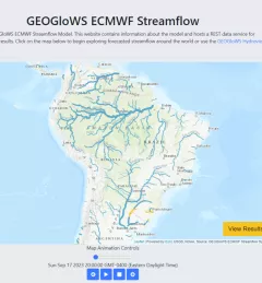
This flood monitoring service utilizes Google Earth Engine and the available LandSAT and SENTINEL data collections, spanning from 2014 to the present date, to determine water surface areas within specific date ranges.
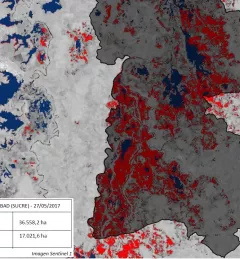
The Improving Resilience and Reducing Risk of Extreme Hydrological Events service provides stakeholders in the Amazon Basin region with improved historical water information and a flood forecasting ability to support greater resiliency to flood disasters.
The Forecasting Seasonal to Sub-seasonal Fire and Agricultural Risk from Drought service provides information for evaluating drought conditions at temporal and spatial resolution to predict fire vulnerability in the Amazon basin.

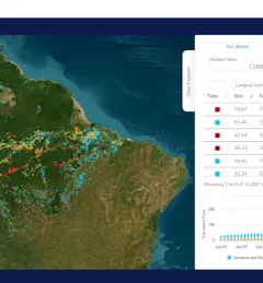
ClimateSERV is a web-accessible system that allows users to access, visualize, and analyze historical Earth observations useful to decision-making across multiple sectors.