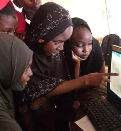
Celebrating International Women's Day
The SERVIR regional hubs around the world celebrated International Women's Day on March 8, 2023. In case you missed the events, tweets, and other posts, here is a round up of highlights.
27 results
The SERVIR regional hubs around the world celebrated International Women's Day on March 8, 2023. In case you missed the events, tweets, and other posts, here is a round up of highlights.
Forest rangers in one of Cambodia’s largest remaining forests now get deforestation alerts based on NASA satellite data.
|Ankit Joshi, SERVIR Southeast Asia and Jacob Ramthun, SERVIR Science Coordination Office
Land Cover Monitoring for Forest Protection and Healthy Ecosystems aims to decrease greenhouse gas (GHG) emissions, while supporting biodiversity conservation and augmenting water conservation.
In this miniseries, we explore why gender matters in applied Earth science, and how we can integrate gender more intentionally into geospatial work.
|Lena Pransky, Diana Kurkovsky West, and Emily Adams | NASA Science Coordination Office
The end of one year and the start of the next provides an opportunity to reflect on past achievements and future goals. In 2023, the SERVIR network worked with local partners in the design and implementation of numerous geospatial services to address complex challenges related to climate change.
SERVIR Southeast Asia convened nearly 100 participants from five countries, for an Inclusive Climate Action Workshop in Chiang Mai, Thailand this February that included representatives of Indigenous communities, women’s groups, and even kids. Here are just a few takeaways from that week.
|Jacob Ramthun, NASA Science Coordination Office
Youth are not only the climate leaders of tomorrow, but their perspectives and innovations are necessary to address climate issues today.
|Lena Pransky and Jacob Ramthun, NASA Science Coordination Office
This Gender Analysis Tool provides clear guidance on a foundational step for service design and programming, to contribute to SERVIR’s goals of ensuring that women, along with men, are realizing equal benefits from SERVIR’s geospatial services.
Collect Earth Online is a custom built, open-source, satellite image viewing and interpretation system developed by SERVIR, FAO, and other partners as a tool for use in projects that require land cover and/or land use data.