Articles & Stories
Making Forecasts a Breeze

NASA supports local experts around the world to help their communities access and use weather and climate information.

27 results
NASA supports local experts around the world to help their communities access and use weather and climate information.

Earlier this year, SERVIR welcomed two virtual interns from the University of Twente's International Institute for Geo-Information Science and Earth Observation in Enschede, the Netherlands. The program, better known as ITC, is one of the world's leading geospatial education programs and is known for attracting students from around the world.
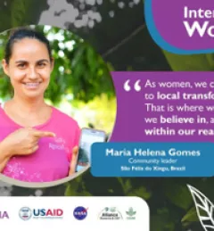
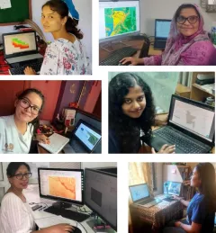
The SERVIR regional hubs around the world celebrated International Women's Day on March 8, 2023. In case you missed the events, tweets, and other posts, here is a round up of highlights.

The Agro-met Advisory Service for National/Local level Planning in Nepal and Bangladesh integrates weather and climate data with information about agriculture practices to provide data analysis support to the professionals responsible for developing agro-met advisory services for government structures and farmers.
In this miniseries, we explore why gender matters in applied Earth science, and how we can integrate gender more intentionally into geospatial work.
|Lena Pransky, Diana Kurkovsky West, and Emily Adams | NASA Science Coordination Office

SERVIR scientists discuss the how the Regional Drought Monitoring and Early Warning System is being used in the Hindu Kush Himalaya region.

The end of one year and the start of the next provides an opportunity to reflect on past achievements and future goals. In 2023, the SERVIR network worked with local partners in the design and implementation of numerous geospatial services to address complex challenges related to climate change.
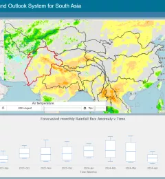
The Regional Drought Monitoring and Outlook System (RDMOS) was developed to help predict, mitigate, and adequately respond to drought vulnerabilities in the HKH region.
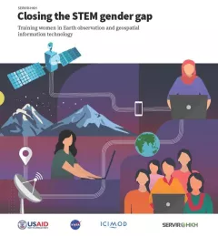
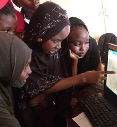
Between 2018 and 2021, SERVIR HKH trained 410 women in “Empowering women in GIT” to bridge the technology and gender gap in the region. Some of the key outcomes of these trainings are summarized in this report.
Since 2018, SERVIR has conducted 12 training programs for young and early-career women in geospatial information technology (GIT), reaching 1,490 women across the region. The training focuses on using technologies to collect, store, analyze, and visualize spatial or geographic data about observing the Earth’s surface and human activity. Participants learn about key concepts and how to use applications that depend on EO data and GIT.
|Jaber Hassan and Poonam Tripathi, SERVIR HKH