Video
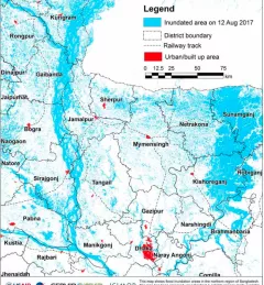
Streamflow Monitoring, Enhancing Flood Early Warning Services, and High Impact Weather Assessment

44 results
The Monitoring and Evaluation of Mangroves in Guyana service brings Synthetic Aperture Radar (SAR) and other remote sensing resources to map the extent and structure of mangrove forests along the coast of Guyana.
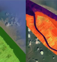
The Monitoring Extreme Weather in the Hindu Kush Himalaya (HKH) service provides a customized numerical weather prediction toolkit to assess high impact convective weather events over the HKH region.
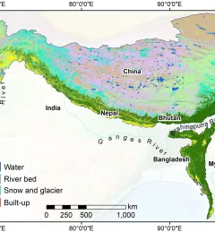
SERVIR-HKH has developed land cover monitoring systems with a modular architecture built on the Google Earth Engine (GEE) computational platform.
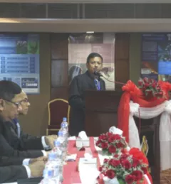
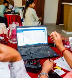
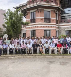
A special workshop was held 22 and 23 December 2014 in Dhaka, Bangladesh, for beneficiaries of the SERVIR-Himalaya Small Grants program to present research outlines, methodologies, and preliminary findings for their projects.

At the Annual Fall Meeting of the American Geophysical Union (AGU), held 15-19 December 2014 in San Francisco, officials from Bangladesh made a big announcement. They are expanding use of a satellite-based flood forecasting and warning system developed by SERVIR.
Working in developing countries around the world, SERVIR seeks to incorporate regional knowledge and perspectives to best meet end user needs in addressing issues such as flood forecasting, forest fire management, landslide hazard, agricultural monitoring, and biomass estimation.
A recent Esri blog features advances made by ICIMOD towards improved disaster management, early warning and response in the Hindu Kush Himalaya region.

This workshop is the third in a series offered by SERVIR Amazonia focused on using remote sensing to monitor mangroves in Guyana.

SERVIR hubs are at the forefront in developing high-quality water information, tools, products, and services that enable partner countries to monitor, measure, and report on water resources and changes, and to better predict and manage water-related disasters.