Articles & Stories
Making Forecasts a Breeze

NASA supports local experts around the world to help their communities access and use weather and climate information.

9 results
NASA supports local experts around the world to help their communities access and use weather and climate information.
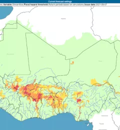
The Flash Flood Vulnerability Mapping service focuses on improving flash flood vulnerability mapping and early assessments of the potential socioeconomic impacts of anticipated floods.
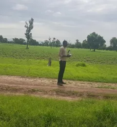
The Crop Type Mapping and Condition Assessment in Senegal service will develop tools for estimating crop yields and provide early warning of food insecurity throughout the sub-region using varied ecosystems in Senegal, which are representative of ecosystems found throughout West Africa.
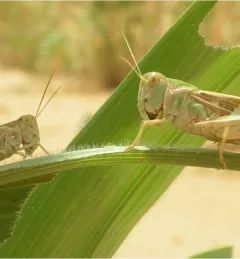
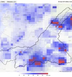
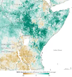
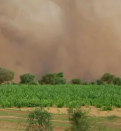
The primary objective of the P-Locust service is to enhance the monitoring and prevention efforts against locust population growth.
With floods and droughts as two of the most catastrophic natural disasters in the regions it serves, SERVIR strives to be on the cutting edge in addressing challenges related to water.
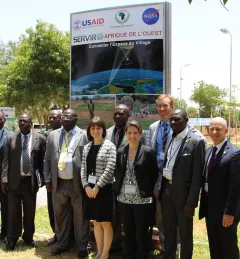
On July 14, 2016, NASA and the U.S. Agency for International Development (USAID) launched SERVIR-West Africa, a joint project to strengthen environmental monitoring in West Africa.
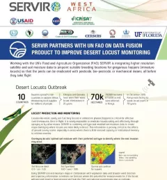
This fact sheet highlights how SERVIR is using satellite data to pinpoint breeding locations for locusts so that the pests can be eradicated before they take flight.
A single desert locust can consume its body weight in vegetation in one day. When 40 million of them gather, they can devour as much food as 35,000 people.
This service focuses on the production of seasonal crop-related weather forecasts for improving the quality of products disseminated to end users such as farmers.