Articles & Stories
Making Forecasts a Breeze
NASA supports local experts around the world to help their communities access and use weather and climate information.

18 results
NASA supports local experts around the world to help their communities access and use weather and climate information.
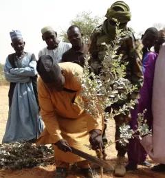
This service supports Farmer Managed Natural Regeneration (FMNR), is a low-cost land restoration technique used to combat poverty, hunger, and Sahara desert encroachments amongst low-income farmers by increasing ecosystem services; and resilience to climate extremes.
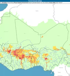
The Flash Flood Vulnerability Mapping service focuses on improving flash flood vulnerability mapping and early assessments of the potential socioeconomic impacts of anticipated floods.

USAID’s 2024-2028 Geospatial Strategy promotes leveraging the power of geospatial data and technology to target the delivery of international programs.

SERVIR will be at the American Geophysical Union (AGU) fall conference December 11 - 15, 2023. We have compiled a list of SERVIR affiliated colleagues who will be presenting throughout the week. Please come and meet us at our talks and posters.

The end of one year and the start of the next provides an opportunity to reflect on past achievements and future goals. In 2023, the SERVIR network worked with local partners in the design and implementation of numerous geospatial services to address complex challenges related to climate change.
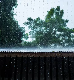
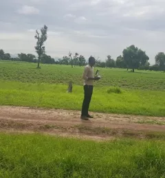
When irrigation isn't available, it's important to know when to expect rain. But with changes to our climate, farmers in West Africa can no longer count on a predictable weather. To mitigate this, SERVIR West Africa works with AGRHYMET to improve access to reliable weather and crop forecasts.
|Jacob Ramthun, SERVIR Science Coordination Office

ClimateSERV is a web-accessible system that allows users to access, visualize, and analyze historical Earth observations useful to decision-making across multiple sectors.
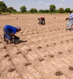
The Crop Type Mapping and Condition Assessment in Senegal service will develop tools for estimating crop yields and provide early warning of food insecurity throughout the sub-region using varied ecosystems in Senegal, which are representative of ecosystems found throughout West Africa.
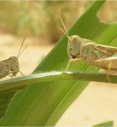
The primary objective of the P-Locust service is to enhance the monitoring and prevention efforts against locust population growth.